Monday, July 30, 2012

Mon, July 30th - Sierra Buttes Lookout Tower

Sunday I took a zero day in Sierra City along with a half-gallon of ice cream.  They had a scale at the Red Moose and I only weigh 160 lbs.  Our trail angel said I need ice cream to fatten up!  N&N and I'm Fine along with lots of new hikers and good conversations on the deck.  Bar-b-cue and red wine for dinner.  Virgo came by and filmed video for his trail angel documentary.

Monday I saw Pacemaker hike in.  I decided to try and finish my blog entries and leave later but got kicked off when the owners left for Reno.  Had a nice breakfast, packed, mailed my bear canister home and joined the hikers on the deck through lunch.  Finally left after an ice cream and got a ride to the trailhead.

Nice water springs on the climb up Sierra Butte.  I left Scooter, Neon, and On-the-Move at the second spring and back tracked to the OVH road and climbed the steep track to the Sierra Butte Summit Tower Lookout.  It's hard to believe you can actually drive this steep rutted trail.  Almost 3 miles round trip from the PCT crossing.  Fantastic views!!!  At the tower you had to climb five sets of metal stairs/ladders to get up the rock spine to the lookout tower.  Very cool.  The next five miles I kept looking back at the tower on the top of the peak as it starred back at me.  Love this section!
Red Moose in Sierra City

Sierra Butte Lookout Tower

View from Sierra Butte Tower

Tower Stairs

Saturday, July 28, 2012

Sat, Jul 28th - Sierra City

Nice hike into Sierra City over some open hills and ridge lines but mostly wooded.  Asked a SoBo hiker if there was a good spot with a view for lunch in the next few miles.  He said, "if I am expecting any I will be sadly mistaken".  Around 2/10th of a mile later I came to a neat "V" shaped pass with loose rock walls, then I saw a nice spot for lunch with views of the surrounding mountains.  Then another 2/10th of a mile farther a great view of Blue Lakes, then another 1/2 mile farther a long winding set of switchbacks with views all around.  Do I just see things differently?  No, it's not Yosemite, but still beautiful.  Then a group of hikers told me about a short cut into town.  Does it miss any pretty sections of the PCT I ask?  No, it's a boring section.  I almost took it but the sign at the trail junction said "Love Falls" was ahead.  I stayed on the PCT and got a good view of the river gorge filled with pot hole formations.  Then climbed up to an abandoned gold mine, an got to see Love Falls and great views looking toward Sierra Butte Mountain.  The Butte was staring me right in the face while hiking to the road into town.  Glad I stayed on the PCT!

In town I met a handful of new PCT hikers at the Red Moose.  I'm Fine left in the evening as usual.  No dinner as the owners was taking the day off so I had the "Gut Buster" 1lb bacon burger with all the fixings at the deli - A PCT Tradition.  No shower either as they had a wedding and rented access to the shower.  Sunday I should be able to get a shower & laundry done.  I'll take a zero day and do resupply and chores in the morning.  Tented with the sound of the river below me with Hotwings, Scrub Rat, Doe Eyes, Neon and On the Move.


Sierra Buttes

Old Gold Mine

Pot Holes

Bridge at Love Falls

Friday, July 27, 2012

Fri, July 27 - Donner Pass

Had a  great sunset yesterday and a view of the moon hovering over the rocky summit of Anderson Peak behind the cabin.  Then a nice sunrise as well this morning.  Saw a few mice at dinner but a note said they can't get onto the table so I put everything there and had no problems. 

Met up with Natty & Navi again on the long ridge line hike this morning but left them at Roller Pass.  Roller Pass is a spot where they had to haul the wagons straight up the rocky slope to go west in the old days.  I left the PCT to hike the longer and higher Judah Loop over the summit of Mt Judah and then over to Donnor Summit.  Very cool rocks to climb and great views of Donnor Pass and Donnor Lake.  Donnor Summit is an out and back then Judah Loop returns to the PCT before Donnor Pass.

After crossing the road I saw a plaque about the Great Summit Train Tunnel that was build to connect the country by train by Chinese workers.  Great views from the other side of the pass of the train tunnel and Donnor Summit.  Here I met a grandfather with his grand kids, age 6 & 7, out on their first hike.  We sat and talked and I ended up with a ham sandwich, strawberries, a power bar, and three new friends. 

A second crossing of Donnor Pass was through a tunnel under the road.  I stopped at the highway rest stop hoping for vending machines but no luck.  A nice plague about the Donnor Party though.  At Castle Pass I thought hard about climbing Castle Mountain but it was a good two miles up and another 2000 feet of elevation.  Save this for another tirp.   The Peter Grubb Hut was crowded, musty, and had lots of tents.  Kind of glad I am not staying here tonight. 

Was going to camp at White Rock Creek but that had lots of tents and mosquitoes too - it's the start of the weekend.  Decided to hike on hoping to camp high on the ridge away from the bugs.  I came to a sign for Snow Bank Spring so I dumped my water and refilled with this fantastic ice cold spring!  I then found a nice spot on the ridge to dry camp cowboy style.  I guessed wrong on the bugs because the wind stopped around 8:30pm and out they came. 
Sunrise from Benson Hut

Anderson Peak - yesterdays sunset hike

Roller Pass

Summit of Mt. Judah

Donnor Summit and view of Donnor Lake/Pass
 

Train Tunnel at Donnor Pass

Thursday, July 26, 2012

Thur, July 26 - A day of side hikes - Benson Hut near mile 1150

I love this trail!  Three small but very exciting side peaks today and some fantastic ridgeline hiking.  Started off with great views, especially of Twin Peaks from my campsite.  As I entered the Granite Chief wilderness I knew I had to climb the Twin Peaks.  Took a short detour on the Tahoe Rim Trail where it splits from the PCT then up the loose rock slopes to the saddle  between the two Twin Peaks.  On up the rocks to the knife edge summit.  Exposed edges and great views especially back toward the lava butte near my campsite.  A register box was on the summit.  When I returned to the PCT I caught up with N&N and also Doe Eyes and Scrubrat. 

The trail continued all morning along the ridges with views of Lake Tahoe and hiked right through the Tahoe Ski Area.  Had lunch on a rock ridge pass with views of the gondola and ski lifts, Lake Tahoe and Squaw Valley.  Down and back up I came to another long ridgeline as we came close to Tinkers Knob.  Yup, another steep rock scramble with great views all around that I had to climb.  Number two side hike today.  Didn't find a register but there were lots of rock circles made on the summit. 

I then hiked around the base of Anderson Peak on the PCT to search for the rumored Sierra Club Ski Hut.  Almost gave up but I decided to drop my pack and climb a small rise to the base of the cliffs on the north side of the peak - Success!    Benson hut will be my home for the night.  But before starting dinner I just had to climb Anderson Peak - my third side hike of the day.  While the summit looked so close it was a longer hike then I thought as you had to find a way around the cliffs by circling around the loose rocks under the cliffs and find a way up the loose steep rock.  Nice hike with great views of the ridge and Tinker Knob from the summit.  A metal Sierra Club register box was found on one of the several possible high points on the large rock summit cone. Another fantastic day!

View from top of Twin Peaks

Twin Peaks in the Granite Chief Wilderness

Looking down at Squaw Valley and Lake Tahoe Ski Area

Granite Chief

Top of Tinkers Knob

Tinkers Knob

Benson Ski Hut and Anderson Peak

Anderson Peak Summit Register

Sunset from Benson Hut
Tinker Knob, one of two side hikes off the PCT today. See snow on left. The other cool climb today was Twin Peaks. Next up Donnor Pass in the morning.

Wednesday, July 25, 2012

Wed, July 25 - Lava Butte

Love my campsite.  Waited till after 8am to get sun on the tent to take a picture.  Natty & Navi and Flatlander & Flower hiked past me while I had coffee.  Dicks pass was pretty with lakes visible on both sides.  Caught up with N&N, and Flatlander and Flower so I guess I hike fast.  The afternoon was more wooded and while nice had very little views.  But when I got over Barker Pass it got exciting again.  Hiked by a large lava? butte that was fun hiking around and climbing on with a view of Lake Tahoe.  The Twin Peaks were also pretty.  I camped near a view of them looking straight up at the lava butte I had been climbing on.  Laying on my sleeping bag after dinner with a cup of tea looking at the clouds swirling around the lava butte above the trees and the 1/4 moon was wonderful.

Lava Butte climbing rocks

View looking up at Butte and clouds from camp
 

Tuesday, July 24, 2012

Tue, July 24th - Echo Lake

Breakfast was great but it cost me over $20.  More then dinner with beer yesterday.  Crepes with hollanday sauce, biscuits and gravy - both homemade.  The hitch back to the trail was bad.  Almost 1-1/2 hours to first ride, then 1-hr for second in a very dirty car with lots of stuff on the floor.  Crammed my  pack on my lap and dropped my water bottle trying to shut the door.  It was then that I think I lost my pint of vodka.  The third hitch was easier up to Echo Lake but at the lake I realized I no longer had my sun hat.  The ride I got offered to drive back and look for it but was not successful.  Then, out of the blue, a local hiker offered me a like new REI sun hat.  Must be worth $45-50.  What a savior!  Sat at a picnic table with Natty and Navi(N&N) along with Special Delivery.  N gave me a beer!  Then N&N and I hiked the next 10 miles together past many many lakes.  Aloha Lake looked similar to 1000 Island lakes .  Very Nice.  I hiked within a mile of Dicks Pass hoping to get above the misquotes.  But it turned out that as I climbed the trail higher the trail turned and I was just above the lakes I was trying to avoid.  Still not many bugs and I had a great view below me.  Passed two new pct hikers: Flatlander and Flower.
Trail Angel and my new sun hat!


Echo Lake

Aloha Lake

Camp below Dick's Pass
 

Monday, July 23, 2012

Mon, July 23rd - 2nd Month Aniversery

Lightning and a 2am light show.  Just a few sprinkles but lots of mosquitoes.  Other then the bugs it was a nice set of high meadows this morning, but overcast.  Meiss Cabin, an old 1800's farm building, was interesting.  And Showers Lake was nice but there were 8-10 tents around the lake.  Hail with sunshine above Benwood Meadow.  Lots of switchbacks down white rocks.  Around highway 50 it started raining and hailing harder.  At Echo Lake it poured.  Met Dazzle at the store.  At Echo Lake store they said they didn't offer PCT stays any more but I had a huge sandwich for $6 and got a ride to Tahoe.  Checked into Apex Inn, laundry in sink, and shopping and Chinese Buffet.  Didn't bother with the Nevada Casinos because it was still a long way away.  I left my gps on yesterday so today I changed the batteries.  First set lasted for 2 months!  Buffet was just ok but at under $20 with beer and tip a real bargain.

Sunday, July 22, 2012

The view from mile 1060 on the PCT! First cell contact since yosemite. Loving this trail!

Sun, July 22 - In the land of Alpine Lakes

Another beautiful day.  Woke up to the view of the tall spires of brown rocks above me through the trees.  All morning climbing  around the badlands of brown rock formations and rock spires.  The trail really took you to all the best features as I climbed up and down the sides of hills and mountains.  At the top of the pass above Blue Lake, the wind was whipping but that just made it more exciting.  The lip of the pass straddled views of blue lakes on both sides.  There are so many side peaks and lakes I would love to explore.  A couple raved about Raymond Lake, 10 miles back, that they spent three days camping at.  Got cell coverage and read email above Blue Lakes while enjoying lunch.  Oh, and I found a bag on the trail with trail mix and ramen noddles. 

The trail down from Blue Lakes, then over the next passes were open and lots of views in all directions.  At Carlson pass I met Spins and Baboon who got a ride to Tahoe and also met Typo from New Zealand.  We shared trail magic of cantaloupe, chips and salsa, and nuts from the rangers girlfriend.  Hiking up the next pass I got my picture taken by a couple who said they would email it.  Got water from a clear stream from right above me in the rocks but no campsite nearby.  Then when I got to the bugger stream I got eaten by mosquitoes.  Probably should have hiked on but it was late and I dropped my pack, slid on pants and coat, and setup tent to get away from them.  Only bad part of another perfect day.


Saturday, July 21, 2012

Sat, July 21st - Spectacular Rock Formations

Another excellent day.  Started out with lots of blowdowns that required some interesting figure-eights to get around. Mostly in the woods with partial views of all the great mountains and valleys.  Lots of small ups and downs with openings thorough meadows with lots of wildflowers.  At one point I crested a pass and there was this huge mountain of a pile of loose black rocks.  Must have been left by a glacier - It was odd because it was a huge hill but at the sides it abruptly ended like someone had dumped it in just that one spot.  Of course I had to climb it.  Short but very loose and steep with several false summits.  Camera battery died while taking a movie on top.  A very cool spot.  Later came to a second black rock peak but only climbed half way, it was to steep and I was tired.  Mid-day I stopped at Asa Lake and rinsed clothes and skinny dipped.  Had lunch while drying clothes and enjoying the sun.  Just as I dressed to leave I heard a group of people and dogs arrive behind me - guess they just missed the show. 

Next came a very cool area of sandy rock formations and jagged rock spires. The trail crested a gap then corkscrewed and switchbacked down the canyon to bring you to every rock feature. Very nice all the way down to Noble Lake then around the next canyon. Found trail magic - cooler of oranges, apples, bread, chips, and cupcakes. Later a hiker gave me some fresh cherries, apricot, and raisins. This fueled me on to go another five miles through some spectacular rock formations and along side steep jagged rock mountains. All very impressive. 27 miles today with a camp right in the middle of the sandstone and jagged rock spires around me. A stream was almost dry but a neat place for the night.


Side hike scramble up Black Rock Pile


Friday, July 20, 2012

Fri, July 20th - Sonora Pass WOW Day!

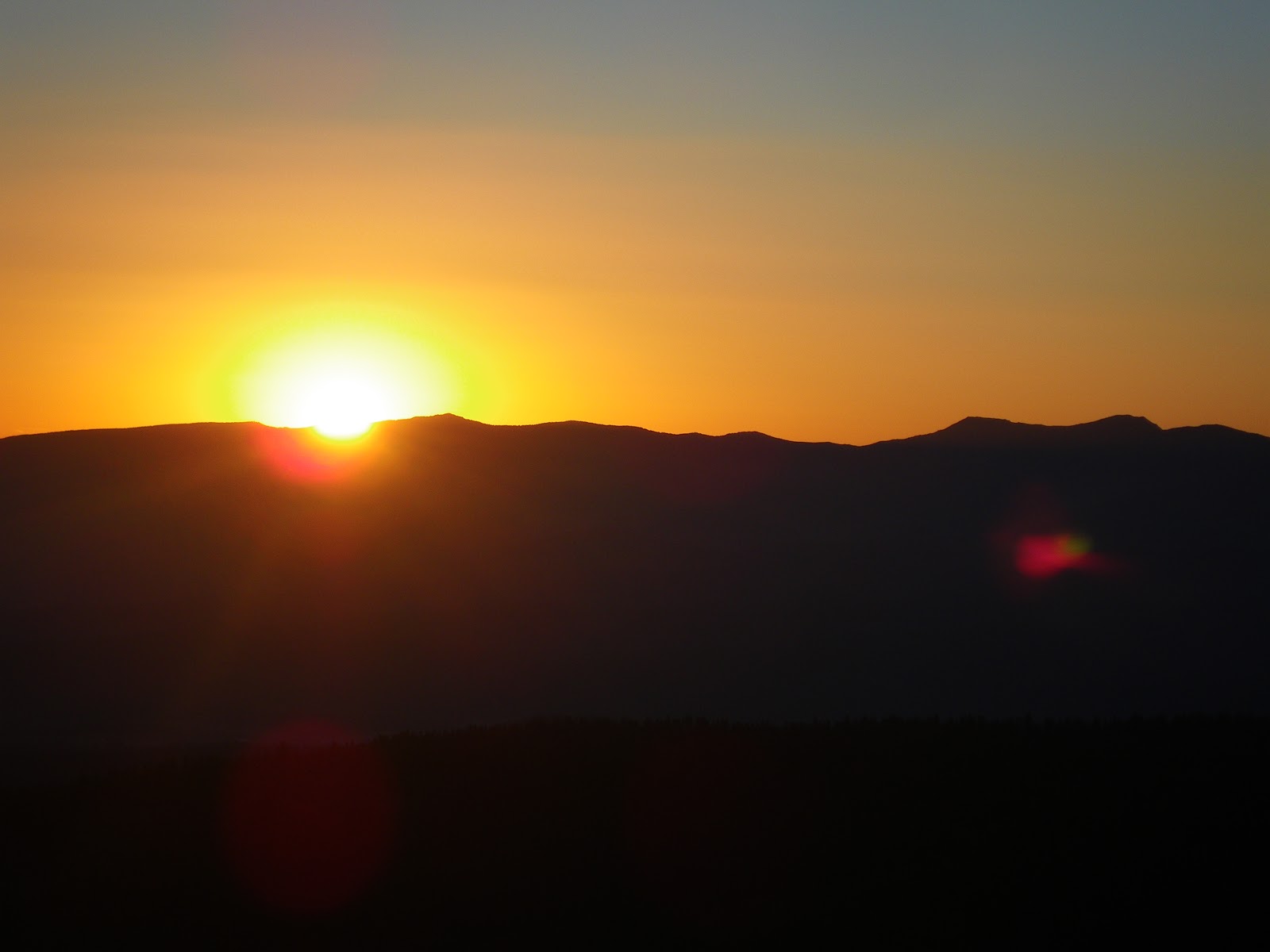
Wow! I don't know what else to say.  This just might be the most scenic and fantastic view day of the whole trail so far.  Climbing up out of Kennedy Canyon the mountains changed to gravelly and sandy slopes with wide open views and wildflowers.  Only a few trees or bushes dotted the landscape and some of the ridges sported ragged rocky edges.  Because it was so open you could see everything, the higher you climbed the better the views got.   Even the lichen on the rocks were full of color. 

The wind was gusty and strong but the sun was shinning and the wind added to the alpine feel.  The trail switch backed up the slopes then along long ridge lines and passes.  At spots I climbed to the lip of the ridges to gaze down on Turquoise lakes and green valleys.  The hills were barren up high and a light brown with rolling slopes spotted with wildflowers and little else.  The patches of trees down lower gave color.  I should definitely return to this area to explore the side canyons and lakes. 

Leverette Lake was very impressive from the ridge but I later learned it had a road and lots of car campers.  So glad I stopped early yesterday so I could enjoy this ridge.  Even higher the mountains around me opened up with patch work quilts of snow accenting the vistas.  Next, as I climbed around another ridge it opened into a huge bowl that was nothing but gravel and sand.  Nothing but a few wildflowers could be seen around me and it was like walking a rocky ridge of  a moon crater or mars landscape.  Then as the trail curved and twisted out of the bowl it opened up again into colors as you looked at the backside of all these lakes I had seen earlier up on the other side of the ridge through the windows. 

Traversing a snow field and taking tons of pictures I approached and ascended a rocky passage through a crest of spires.  Passing through the pass at the top of the spires the valley exploded in color below me.  Greens and blues in the valley to the right and then on the left it was what I call the Painted Canyon.  Instead of the browns of the previous canyons this area was a wash with colors:  White, reds, oranges, all shades of brown and grey and accented with greens.  And again, every shade of color could be found in the wildflowers that speckled the sides - yellow, reds, violets, magenta, turquoise, pink, white, blue...

As I climbed the long and winding trail down to the Sonora Pass the views of the valleys and mountains ahead were leaving me in awe.  Stopping to fill my water bottles with melting snow and got a brain freeze - but the water tasted soooo good.  Sonora pass had  a monument that talked about the wagon trains that opened the pass and Grizzly Adams involvement in the pass.  And it didn't end at the pass - up, up, and up the switch backs went as I ascended the flanks of Sonora Mountain.  Large spires and rock formations carved by wind accented the sides and the views back across the pass to where I had come were wonderful.  A late second lunch on the top of the rock spires had me thinking of climbing the true summit but it was still a mile away and a steep up since the trail hung on the sides, just below the summit cone and circumnavigate around the peak.  I could see all the views anyway and it didn't look like a place I could camp without being very exposed on the rocky slopes. So I guess I will have to return here another day and pushed on to the valley ahead to camp in another seven miles. 

The trail clung to the sides with great views as I rounded the top and it opened up into another lovely valley.  The terrain changed to a maze of white rocks, mountain tarns, and then great fields of yellow, white and blue flowers around the white rocks.  Hiking down into the valley the wildflowers got thicker and more melt water formed into streams.  I finally found a nice stream side camp for the night.  One of the best days ever on the PCT!