PS. The play at the Rock Mountains Repertory Theater, Peter Pan, was excellent. A cast of 35 and great flying special effects and costumes.
Thursday, June 27, 2013
Thur, 27 June - Grand Lakes
Enjoying a great view from the porch of the Shadowcliff Hostel perched on the hill above the lake and surrounded by mountains. Had a black bear in camp last night and saw moose on the way into town this morning. Staying an extra day in town and hope to hike some in RMNP. Part of the trail is closed due to fire so I will discuss options with the rangers. Maybe I will also see a play at the theater in town.
Wed, 26 June - forests, lakes, and blowdowns
Hiking through forests, meadows, lakes and blowdowns as I descended to almost 8000 feet. Hot and buggy down here.
After Monarch Lake I had hoped to get an ice cream at the Small Moose Trading Post but a sign said closed. Just as I disappointedly turned to leave the owner called down and said to come on in. Free Trail Magic Heaven with muffins, drinks, brownies and ice cream!
Thought I would easily make it into Grand Lake but the route around Lake Granby and up on Knight Ridge was difficult and slow. Unmaintained, overgrown, and a blowdown nightmare. You would cross over blowdowns and never find a trail on the other side repeatedly. Very challenging.
At Shadow Mountain Lake it was clear I wouldn't get to the hostel till 9pm so I found a place to stealth camp outside of Rocky Mountain National Park. Had to chase away a black bear at dusk and wondered if he would return all night. Looking forward to breakfast in Grand Lakes.
Tue, 25 June - Parry Peak and Mt Bancroft without the knife's edge
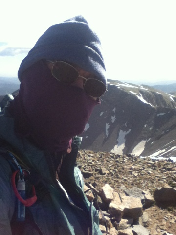
The wind kicked up around 2:00am and continued all day. The tent held up well but the noise of the wind and fear for my tent made for poor sleep. Packed up in strong winds at 6:00am to protect my tent and climbed up to the summit of Mt Flora. I decided to attempt the cross country route over the divide to James Peak. The winds were at least 35-40 mph with gusts even higher and I had to put all my layers on including my rain coat, winter hat and balaclava, and my heavy gloves over top my wind gloves.
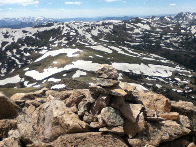
It was an exciting, if difficult, climb in the wind but the views were spectacular. Mt Eva had an old shell of a radio building which gave a break to the wind to let me get a snack but the rest of the route had the wind howling in my ears. Mt Parry was a great climb but when I got to Mt Bancroft the winds were up around 45mph and it was difficult to move around. I looked down at the scary knife edge that connects Bancroft with James peak and I could hear the wind just whipping through and I chickened out. Leys map notes it has lots of scrambling using your hands, is a bit technical, and not recommended if you don't do well with exposure.
I had really wanted to try it but with the high winds it didn't seem safe. Still I took a long time to decide. You could see the official CDT trail after James Peak and it was just a short half mile of knife edge and another half mile of safer hiking on talus? I would be rethinking my decision as i made the long difficult rocky climb down toward Loch Lamond lake then the long climb around and up James Peak. At least I got to glissade down a snow field.
Down lower where the wind was less it was easy to think I had made a poor decision given the elevation loss and gain I had to make but when I got on top of James and saw the knife edge from the other side I was glad I skipped it.
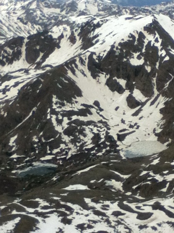
The wind continued as I spent most of the day hugging the divide, mostly with little to no tread to follow. The views, especially of iceberg lake and the many lakes were fantastic. Dropped down to Rollins Pass and the next section, around the Devils Thumb was fun. A long and exciting day and my ears are still ringing with the memory of the sound of the winds.
Mon, 24 June - Vasquez Peak!
Woke to a climb from 10,000 to an unnamed peak at almost 13,000. Good morning wake up. Back on the divide and entering Vasquez Peak Wilderness it seemed just rude to not climb Vasquez Peak. So off I go on a cross-country trail alternate to stay high on the divide and straight up Vasquez Peak. The traverse after reaching the summit was like climbing several more mountains as you go over one knob after another till finally a very steep down to rejoin the CDT. Snow blocked the easiest route down so I just aimed for the shortest. It was a very steep descent and I didn't realize just how steep until I climbed the next peak, Stanley mountain, and looked back. I climbed down that?
The next section was wonderful for several miles as it was alpine, very high, and mostly flat with views all around. Then down to Berthound Pass and up to just shy of Mount Flora. I am camping high on the divide where I found a stone wind wall that I hope will protect my tent. I am thinking of taking the knife edged divide alternate over Parry Peak and don't want to camp there so it's this exposed ridge tonight. The views are outstanding!
Sun, 23 June - Two more 14ers, Grey and Torreys
Another unbelievably prefect day! Woke to frost on the tent and ice in my water bottle but it warmed up nicely and had great weather. On the hike back up to the divide I passed a couple of short icy sections that were so frozen it was hard to kick safe steps into. But after a long climb up to Argentine Pass the real adventure began.
Hiking and climbing over the divide to Mount Edward was very scenic but from Edward the view toward Grey and Torreys was down right scary! The route, I will not call this a trail, was along a knife edge of rocky cliffs with little room for a single boot print. My fear of heights had my legs shaking like jello. It just didn't look possible. Only made it through by concentrating on only the next ten feet at a time. It was all doable but your mind kept worrying about what was over the very next rock. Very stressful but so unbelievably rewarding to accomplish. And the views!!!
Grey Peak and Torrey's Peak were easy after the knife edge and the views from these two 14,000 foot peaks a real treat. Met a great group of hikers on Grey, see photo, and they treated me to trail magic(gatoraid and water) on the roadwalk down toward the i70 road crossing. Not a lot of mileage today but a fantastic day!
Sat, 22 June - From peak to peak high on the divide!
An outstanding day high in the alpine zone! As I left the Colorado trail I meet a couple that is following my blog - small world. After the CDT breaks with the CO trail it gets really interesting. Few if any markings or cairns and only faint tread if at all in places. You simply find your own route alone the edge of the divide crossing peak after peak. This is everything I expected from the CDT. I met up with "E" a few times but otherwise had the trail to ourselves despite it being a Saturday.
The section from Glacier Peak and over Whale Mtn, Geneva Peak, Sulivan Mtn and over Santa Fe Peak was absolutely stunning! All 12-13,000 foot peaks connected by alpine ridges and lots of wildflowers. Even met a family of mountain goats.
Around Santa Fe Peak the wind got cold and strong and after descending to a high pass I had trouble finding the trail. Finally I realized it just went right over a cliff with a huge snow cornice and snow field below. No sign of a trail and I wasn't even sure it was the right way until I saw footprints and glissade tracks far below.
I thought I found some footprints and a possible route around the cornice and onto the snow field but as I descended it turned into a full blown rock climb. At one point a grabbed a large boulder, the size of a large microwave, for support. Bad idea; it rolled and fell scrapping my leg and cascading down the cliff. A close call and other than a bruise and scraped leg I made it safely down onto the snowfield and eventually off the steep slope. Met two ATV campers who were watching my descent and shared snickers bars with me. One of the most scenic alpine mountain sections so far!
Fri, 21June - Summer Solstice
Trail Magic soda and snacks as I hiked out from Tiger Run. This section is very popular with the mountain bikers and it was like playing dodge ball as they came down switchbacks and hidden curves. Everyone was friendly but it was stressful wondering if someone might be riding down from above and you had to keep looking up and then you were not watching you feet and would stumble on a rock or root. This lasted for almost 15 miles. Today is the solstice hike naked day. But with all the bikers I only hiked a short time. Camping by a stream with the sound of the water,
Thursday, June 20, 2013
Thursday, 20 June - Copper Mtn and Breckenridge
Hiked around Copper Mtn and Wheeler Flats Ski/golf megapolis. Skipped stopping in this huge tourist trap. Started the Grays-Torrey's Peak alternate which begins with a long climb to the ridge and peaks. Great views and of course lots of snow to mush through on the north side on the long climb down to where you can get a free bus into Breckenridge. The owners of the Fireside Inn(and dorm) are very hiker friendly, did my laundry for me and they have a hot tub!
Wed, 19 June - Elk Ridge and Kokomo & Searle Pass
Stopped on the way out of town to have a women repair the zipper on my packs hip pocket. Back at Tennessee Pass I checked out the 10th Mountain Division WWII Memorial. On trail I passed the ruins of what looked like a large kiln. Up near the Mountain Divisions Camp Hale site I saw a large ammo bunker and warnings about asbestos and old ammunition.
Then it's up lots of switchbacks to Kokomo Pass. The views of the open summits and mountains from Kokomo Pass, up and over Elk Ridge, and all the way to Searle Pass where wonderful. Of course the snow returned as I climbed Elk Ridge starting with about 50 meters of angled snow to cross. Then lots of on and off the snow along the route to Searle Pass. Fortunately it mostly held your weight but also was soft enough to kick steps. A very pretty section.
Tuesday, June 18, 2013
Tue, June 18 - Leadville, highest incorporated city in North America
Hiked over rocky rolling hills and some patchy snow to Tennessee Pass. Trail magic at the pass! Then a quick hitch into town and the Leadville Hostel. Very impressive hostel! Borrowed a bike and got groceries. Had a double dinner at Quincy Steakhouse including a 16 oz filet, lasagna, two baked potatoes, salad, and a couple of margaritas. With an ice cream for dessert of course.
Mon, 17 June - Mt Massive, second highest In CO
Side hike up Mount Massive today. The second highest peak in Colorado and in my opinion an even better view then Mt Elbert. The summit ridge was rocky and a bit of a knifes edge with little room to share. Some lingering snow added a few hundred feet of interesting snow steps. The best part after the fantastic views was a long glissade down that covered a 20 min hike down in less them a minute. Even had a marmot pose on the summit.
Just a little grapple snow falling at times but you could see dark clouds of snow crawling over the other mountains. The section around the fish hatchery had so many fresh new axe blazes on the trees its as if they marked it in brail for the blind. The afternoon and evening saw lots of dark clouds and lots of thunder in the distance. When the rain finally reached me I camped by a nice lake to avoid hiking in the rain.
Sun, 16 June - Mt Elbert, 14,433 feet
My nephew David, his roommate and I attempted a climb of Mt Elbert today. Near the summit cone the weather turned to snow with heavy winds and thunder. Still almost a mile and about an hour and a half still to go we decided it was unsafe to summit. We down climbed to a spot that I thought was safe and I said goodbye to David and planned to camp and wait out the storm.
It did clear and I made the long trek to the summit of the tallest peak in the US Rocky Mountains, high point of Colorado, and second highest peak in the lower 48 states. Met a couple on top that just got engaged! Nice views but then the thunder storms came back and I headed down. The whole trail today was filled with marmots, especially at the summit. We also saw tons of them on the road to Twin Lakes as well as seeing a coyote and some deer.
The rain got heavy as I hiked over toward Mt Massive so I am camping about a mile short of the trail that leads to the summit. Hoping for good weather for my side hike attempt on Mt Massive, second highest peak in CO, in the morning.
Subscribe to:
Comments (Atom)


